Springfield weatherWhat’s on in Springfield →
Bolivar

Get out of town

Day trips from Springfield

13 nearby parks, towns and places to explore, ordered by straight-line distance.

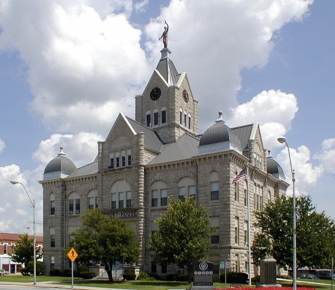
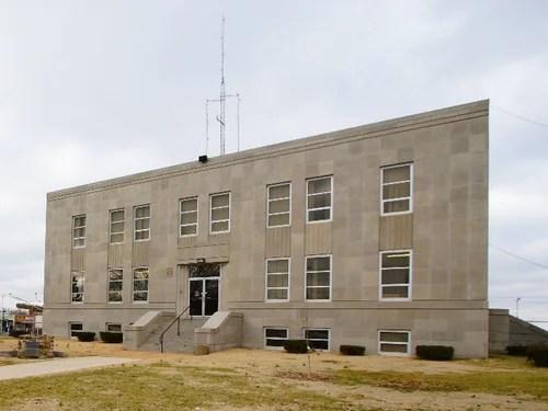
MarshfieldTown

Marshfield

23 miles east · straight-line distanceAbout 30 min by car (28 road miles, typical traffic, checked October 2026)

City in Missouri, United States.

Confirm the visitor entrance, hours, reservations, access and seasonal conditions. Islands or water destinations may require different transport.
BolivarTown

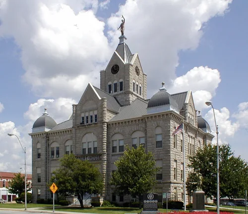
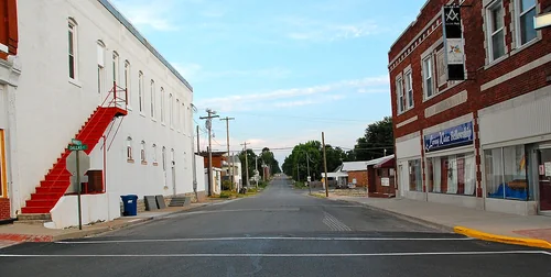
Bolivar

28 miles north · straight-line distanceAbout 35 min by car (30 road miles, typical traffic, checked October 2026)

City and county seat of Polk County, Missouri, United States.

Confirm the visitor entrance, hours, reservations, access and seasonal conditions. Islands or water destinations may require different transport.
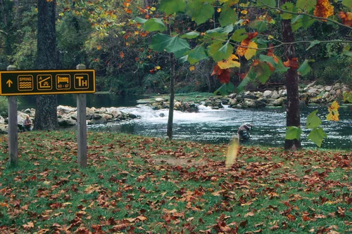
Mount VernonTown

Mount Vernon

30 miles west · straight-line distanceAbout 30 min by car (32 road miles, typical traffic, checked October 2026)

City in and county seat of Lawrence County, Missouri, United States.

Confirm the visitor entrance, hours, reservations, access and seasonal conditions. Islands or water destinations may require different transport.
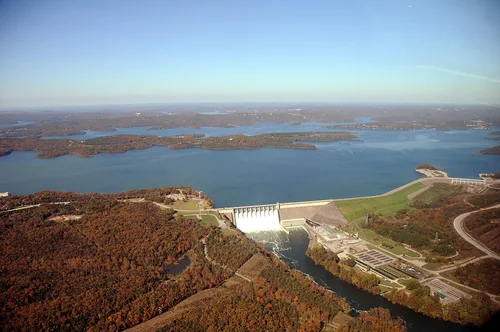
Things to do

Silver Dollar City

38 miles south · straight-line distanceAbout 50 min by car (49 road miles, typical traffic, checked October 2026)

Amusement park.

Confirm the visitor entrance, hours, reservations, access and seasonal conditions. Islands or water destinations may require different transport.
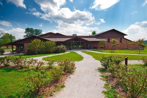
Town

Branson

40 miles south · straight-line distanceAbout 50 min by car (46 road miles, typical traffic, checked October 2026)

City in Taney County, Missouri, United States.

Confirm the visitor entrance, hours, reservations, access and seasonal conditions. Islands or water destinations may require different transport.
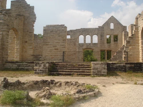
Bennett Spring State ParkState park

Bennett Spring State Park

42 miles northeast · straight-line distance

State park of Missouri.

Confirm the visitor entrance, hours, reservations, access and seasonal conditions. Islands or water destinations may require different transport.
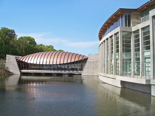
Table Rock State ParkState park

Table Rock State Park

43 miles south · straight-line distance

State park in southwest Missouri.

BoatingCampingFishingHikingNature educationPicnickingAgency site ↗

Confirm the visitor entrance, hours, reservations, access and seasonal conditions. Islands or water destinations may require different transport.
George Washington Carver National MonumentNational park site

George Washington Carver National Monument

60 miles west · straight-line distance

National monument in the United States.

HistoryPicnickingAgency site ↗

Confirm the visitor entrance, hours, reservations, access and seasonal conditions. Islands or water destinations may require different transport.

Ha Ha Tonka State ParkState park

Ha Ha Tonka State Park

60 miles northeast · straight-line distance

State park in Missouri, United States.

Confirm the visitor entrance, hours, reservations, access and seasonal conditions. Islands or water destinations may require different transport.

Crystal Bridges Museum of American ArtThings to do

Crystal Bridges Museum of American Art

76 miles southwest · straight-line distanceAbout 1 hr 55 min by car (128 road miles, typical traffic, checked October 2026)

Art museum in Bentonville, Arkansas.

Confirm the visitor entrance, hours, reservations, access and seasonal conditions. Islands or water destinations may require different transport.

Lake

Lake of the Ozarks

78 miles northeast · straight-line distance

Reservoir in central Missouri, United States.

Confirm the visitor entrance, hours, reservations, access and seasonal conditions. Islands or water destinations may require different transport.

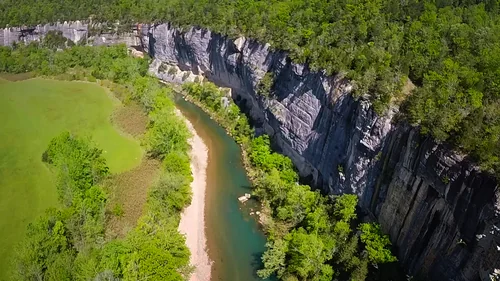
Buffalo National RiverNational park site

Buffalo National River

89 miles south · straight-line distance

National river in northern Arkansas, USA.

Confirm the visitor entrance, hours, reservations, access and seasonal conditions. Islands or water destinations may require different transport.

Town

Jefferson City

112 miles northeast · straight-line distanceAbout 2 hr 15 min by car (137 road miles, typical traffic, checked October 2026)

Capital city of the U.S. state of Missouri and seat of Cole County.

Confirm the visitor entrance, hours, reservations, access and seasonal conditions. Islands or water destinations may require different transport.

Driving times are typical estimates from the city center without live traffic, Powered by Geoapify · © OpenStreetMap contributors.

Distances are straight-line measurements from the city, not driving distance. Saved road estimates have no consistently recorded source date and are not current traffic; estimates to park centers, water locations or inconsistent routes are omitted. Named-destination route links are not verified entrances. Place descriptions come from Wikidata; photo credits below include recorded capture dates when available. A photograph does not show current conditions.

Outdoor places near Springfield

40 recreation areas and campgrounds within 134 miles, from Recreation.gov. Filter by what you want to do.

Recreation area

American National Fish and Wildlife Museum: Wonders of Wild

2 miles south · straight-line distanceSmithsonian Institution Affiliations Program

The American National Fish and Wildlife Museum, Wonders of Wildlife, is a $52 million, 92,000-square-foot museum celebrating man's interaction with nature and our responsibility to manage wildlife resources.

Ranger programs

Recreation area

Wilson's Creek National Battlefield

10 miles southwest · straight-line distanceNational Park Service

Wilson's Creek was the first major Civil War battle fought west of the Mississippi River, and where the first Union general was killed in action.

HikingHistoryHorseback riding

Campground

Cobb Ridge

25 miles southeast · straight-line distanceAbout 50 min by car (38 road miles, checked October 2026)USDA Forest Service

Cobb Ridge Campground is adjacent to the Chadwick Riding area, which is popular among and off-road vehicles (dirt bikes; ATVs and side by sides 50 inches or less) enthusiasts.

BikingCamping

Campground

Cedar Ridge (Mo)

33 miles northwest · straight-line distanceAbout 1 hr by car (50 road miles, checked October 2026)US Army Corps of Engineers

Cedar Ridge is located on Stockton Lake in the scenic Ozark Mountains of southwestern Missouri.

BoatingCampingFishingSwimmingWater sports

Campground

Masters (MO)

34 miles northwest · straight-line distanceAbout 50 min by car (46 road miles, checked October 2026)US Army Corps of Engineers

Masters is located on Stockton Lake in the scenic Ozark Mountains of southwestern Missouri.

BoatingCampingFishingPicnickingSwimming

Campground

Ruark Bluff East

35 miles northwest · straight-line distanceAbout 1 hr 5 min by car (49 road miles, checked October 2026)US Army Corps of Engineers

Ruark Bluff East Campground is a shady campground located on Stockton Lake in the scenic Ozark Mountains of southwestern Missouri.

BoatingCampingFishingSwimmingWildlife viewing

Campground

Ruark Bluff West

35 miles northwest · straight-line distanceAbout 1 hr 5 min by car (50 road miles, checked October 2026)US Army Corps of Engineers

Ruark Bluff West is a shady campground located on Stockton Lake in the scenic Ozark Mountains of southwestern Missouri.

BoatingCampingFishingSwimmingWildlife viewing

Campground

Cape Fair

36 miles south · straight-line distanceAbout 1 hr 5 min by car (46 road miles, checked October 2026)US Army Corps of Engineers

Cape Fair is a spacious and shady campground that sits along the James River Arm of Table Rock Lake.

BikingBoatingCampingFishingHikingKayakingPhotographyPicnicking

Campground

Aunts Creek

38 miles south · straight-line distanceAbout 1 hr by car (47 road miles, checked October 2026)US Army Corps of Engineers

Aunts Creek campground is located on the James River Arm of Table Rock Lake. With easy access to the highly productive waters of the James River Arm, fishermen and campers looking to fish, will find no shortage of angling opportunities.

BikingBoatingCampingFishingHikingPhotographyPicnickingRanger Station

Campground

Hawker Point

38 miles northwest · straight-line distanceAbout 1 hr 20 min by car (63 road miles, checked October 2026)US Army Corps of Engineers

Hawker Point Campground is a shady campground located on Stockton Lake in the scenic Ozark Mountains of southwestern Missouri.

BoatingCampingFishingWildlife viewing

Campground

River Run Park

39 miles south · straight-line distanceAbout 55 min by car (49 road miles, checked October 2026)US Army Corps of Engineers

River Run Park is conveniently located just below Powersite Dam allowing quick lake access for fishing or recreational watersports. Recreation Hiking, birding, all types of water sports, and in-season hunting are featured attractions.

BoatingCampingSwimming

Campground

Crabtree Cove

40 miles northwest · straight-line distanceAbout 55 min by car (50 road miles, checked October 2026)US Army Corps of Engineers

Crabtree Cove is a shady campground located on Stockton Lake in the scenic Ozark Mountains of southwestern Missouri.

BoatingCampingFishingHikingWildlife viewing

Campground

Indian Point

40 miles south · straight-line distanceAbout 55 min by car (51 road miles, checked October 2026)US Army Corps of Engineers

Indian Point is a green and spacious campground on the White River Arm of Table Rock Lake in the mountainous Missouri countryside.

BoatingCampingFishingHikingKayakingPhotographyPicnickingRanger Station

Campground

Orleans Trail

41 miles northwest · straight-line distanceAbout 1 hr 10 min by car (58 road miles, checked October 2026)US Army Corps of Engineers

Orleans Trail Campground is a shady campground located on Stockton Lake in the scenic Ozark Mountains of southwestern Missouri.

BoatingCampingFishingSwimmingWildlife viewing

Campground

Beaver Creek (Mo)

42 miles south · straight-line distanceAbout 1 hr 5 min by car (56 road miles, checked October 2026)US Army Corps of Engineers

Escape from the hustle and bustle of city-life at Beaver Creek, a small, quiet campground tucked between a forested area and the lower shores of Bull Shoals Lake.

BoatingCamping

Campground

Lightfoot Landing

42 miles north · straight-line distanceAbout 1 hr 10 min by car (55 road miles, checked October 2026)US Army Corps of Engineers

Lightfoot Landing is a smaller campground compared to neighboring park areas, making it a more quiet and peaceful location for boating and fishing on Pomme de Terre Lake, known as the ''Gem of the Ozarks.'' Recreation The lake is well…

CampingPicnicking

Campground

Moonshine Beach Rec. Area

42 miles south · straight-line distanceAbout 55 min by car (53 road miles, checked October 2026)US Army Corps of Engineers

Moonshine Beach Recreation Area is a very popular sandy swimming beach along the shores of Table Rock Lake.

BikingBoatingCampingHikingSwimmingWater sports

Recreation area

Stockton Lake

42 miles northwest · straight-line distanceUS Army Corps of Engineers

A popular lake in the scenic Missouri Ozarks.

BoatingCampingFishingHikingHorseback ridingHotel/Lodge/Resort Privately OwnedPicnickingWater sports

Campground

Stockton Park (MO)

42 miles northwest · straight-line distanceAbout 1 hr by car (54 road miles, checked October 2026)US Army Corps of Engineers

Stockton Park is located on Stockton Lake in the scenic Ozark Mountains of southwestern Missouri.

Camping

Recreation area

Table Rock Lake

43 miles south · straight-line distanceUS Army Corps of Engineers

Winding through the valleys of the Ozark Mountains, from Branson, Missouri to Eureka Springs, Arkansas, Table Rock Lake is a paradise for boaters, scuba divers, campers and fishermen alike.

BoatingCampingFishingHikingNature educationPicnickingWater sportsWildlife viewing

Recreation area

Pomme De Terre Lake

47 miles north · straight-line distanceUS Army Corps of Engineers

Cool, clear spring waters make this lake the "Gem of the Ozarks."

BoatingCampingFishingHikingHotel/Lodge/Resort Privately OwnedNature educationPicnickingWater sports

Recreation area

George Washington Carver National Monument

60 miles west · straight-line distanceNational Park Service

The young child known as the "Plant Doctor" tended his secret garden while observing the day-to-day operations of a 19th century farm.

HistoryPicnicking

Recreation area

Beaver Lake

63 miles southwest · straight-line distanceUS Army Corps of Engineers

Nestled in the Ozark Mountains of northwest Arkansas, Beaver Lake is a nature lover's delight during all seasons.

BoatingCampingFishingHikingPicnickingWater sportsWildlife viewing

Recreation area

Pea Ridge National Military Park

66 miles southwest · straight-line distanceNational Park Service

On March 7-8, 1862, over 23,000 soldiers fought here to decide the fate of Missouri which was a turning point of the war in the Trans-Mississippi. This 4,400-acre battlefield honors those who fought and died on these hallowed grounds.

BikingHikingHistoryHorseback ridingWildlife viewing

Recreation area

Bull Shoals Lake

71 miles southeast · straight-line distanceUS Army Corps of Engineers

Bull Shoals Lake, located in the beautiful Ozark Mountains, is popular year-round as each season unfolds a new panorama. Summer contrasts lush green hardwoods and cedar glades against towering rocky bluffs and unusual rock formations.

BikingBoatingCampingHikingHotel/Lodge/Resort Privately OwnedNature educationPicnickingWater sports

Recreation area

Harry S. Truman Lake

73 miles north · straight-line distanceUS Army Corps of Engineers

Located adjacent to the Lake of the Ozarks, Truman features excellent fishing, a regional visitor center and powerplant exhibit area. Rugged hills, scenic bluffs, hardwood forest and prairie offer some of the best scenery in the State.

BikingBoatingCampingFishingHikingHorseback ridingHotel/Lodge/Resort Privately OwnedOff-highway vehicles

Recreation area

Buffalo National River

84 miles south · straight-line distanceNational Park Service

Established in 1972, Buffalo National River flows freely for 135 miles and is one of the few remaining undammed rivers in the lower 48 states.

CampingFishingHikingPaddlingWildlife viewing

Recreation area

Fort Scott National Historic Site

88 miles northwest · straight-line distanceNational Park Service

Promises made and broken! Who deserves to be free? The fight for freedom! Soldiers fighting settlers! Each of these stories is a link in the chain of events that encircled Fort Scott from 1842-1873.

History

Recreation area

Norfork Lake

89 miles southeast · straight-line distanceUS Army Corps of Engineers

Norfork Lake provides both open breezy stretches for sailing and quiet, secluded coves which are ideal for water sports. Undeveloped shoreline allows for ample room to enjoy the hills and hollows.

BoatingCampingFishingHikingNature educationOff-highway vehiclesPicnickingWater sports

Recreation area

Mark Twain National Forest

97 miles northeast · straight-line distanceUSDA Forest Service

BackpackingBikingBird WatchingBoatingCampingCanoeingDispersed CampingFishing

Recreation area

Ozark Plateau National Wildlife Refuge

100 miles southwest · straight-line distanceFish and Wildlife Service

Ozark Plateau National Wildlife Refuge was established in 1986 (formerly Oklahoma Bat Caves National Wildlife Refuge until 1995) to protect the federally threatened and endangered species found in the Ozark Plateau’s cave system, including…

HuntingRanger programs

Recreation area

Marais des Cygnes National Wildlife Refuge

103 miles northwest · straight-line distanceFish and Wildlife Service

Marais des Cygnes National Wildlife Refuge was established in 1992 primarily for the preservation and restoration of bottomland hardwood forest.

BirdingBoatingFishingHikingHuntingNon-Motorized BoatingPaddlingPhotography

Recreation area

Ozark National Scenic Riverways

112 miles east · straight-line distanceNational Park Service

Ozark National Scenic Riverways is the first national park area to protect a river system. The Current and Jacks Fork rivers are two of the finest floating rivers found anywhere.

CampingFishingHikingHistoryHorse CampingHuntingPaddlingWildlife viewing

Recreation area

Big Hill Lake

120 miles west · straight-line distanceUS Army Corps of Engineers

to Kansas' "Little Ozarks"! Located 5 miles east of Cherryvale, Kansas. Five beautiful park areas are offered by the Corps of Engineers for camping, picnicking, and other outdoor activities.

BoatingCampingFishingHikingHistoryHorseback ridingPicnickingWater sports

Recreation area

Ozark Lake

124 miles south · straight-line distanceUS Army Corps of Engineers

Ozark Lake extends 36 miles along the Arkansas River. The shoreline of the lake varies from steep bluffs and tree-lined banks to open farm lands and level fields. Many outdoor activities offer excellent recreational opportunities.

BoatingCampingFishingHikingPicnickingWater sportsWildlife viewing

Recreation area

Big Muddy National Fish and Wildlife Refuge

126 miles north · straight-line distanceFish and Wildlife Service

The lower Missouri River is the largest free-flowing river in the United States, encompassing nearly 1.5 million acres of bottomland habitat for fish, wildlife and plants, while providing commercial transportation and recreation…

BirdingBoatingFishingHikingHuntingNature educationNon-Motorized BoatingPhotography

Recreation area

Hillsdale Lake

132 miles northwest · straight-line distanceUS Army Corps of Engineers

Managed by the Kansas State Park System, Hillsdale offers camping, fishing, boating, hunting, hiking, equestrian trails, and relaxation within 40 minutes of the Kansas City Metropolitan Area.

BikingBoatingCampingFishingHorseback ridingNature educationPicnickingWater sports

Recreation area

Dardanelle Lake

134 miles south · straight-line distanceUS Army Corps of Engineers

Located near the Ozark and Ouachita National Forests, the picturesque shoreline, excellent fishing and abundant wildlife provide ideal conditions for nature enthusiasts and camera bugs.

BikingBoatingCampingFishingHotel/Lodge/Resort Privately OwnedNature educationPicnickingWater sports

Recreation area

Longview Lake

134 miles northwest · straight-line distanceUS Army Corps of Engineers

Located in Kansas City, Grandview and Lee's Summit, Missouri. Longview, a 930 acre lake provides recreational facilities including camping, 14 picnic shelters, swimming beach, 27 hole golf course, softball fields, 6 miles of paved bicycle…

Wildlife viewing

Recreation area

Ozark-St. Francis National Forests

134 miles south · straight-line distanceUSDA Forest Service

BikingBoatingCampingFire Lookouts/Cabins OvernightFishingHikingHorse CampingHorseback riding

Recreation areas and campgrounds from Recreation.gov's directory, checked October 9, 2026. Listings are not live availability: check Recreation.gov or the managing agency for open dates, fees, reservations and conditions. Directions go to the listed coordinates, which may not be the entrance. Campground driving times: Powered by Geoapify · © OpenStreetMap contributors.

Questions

What day-trip ideas are near Springfield?

This guide includes Marshfield, Bolivar, Mount Vernon, Silver Dollar City, Branson. Places are ordered by straight-line distance. Confirm visitor access, opening hours and current travel conditions before choosing a trip.

How far is Marshfield from Springfield?

Approximately 23 miles east in a straight line; driving takes about 30 min over 28 road miles in typical traffic (Geoapify, checked October 2026). This is not current traffic or a route to a verified visitor entrance. Use the named destination and confirm the appropriate entrance or transport.

How far is Bolivar from Springfield?

Approximately 28 miles north in a straight line; driving takes about 35 min over 30 road miles in typical traffic (Geoapify, checked October 2026). This is not current traffic or a route to a verified visitor entrance. Use the named destination and confirm the appropriate entrance or transport.

How far is Mount Vernon from Springfield?

Approximately 30 miles west in a straight line; driving takes about 30 min over 32 road miles in typical traffic (Geoapify, checked October 2026). This is not current traffic or a route to a verified visitor entrance. Use the named destination and confirm the appropriate entrance or transport.

Where can I camp near Springfield?

Recreation.gov lists 16 campgrounds within 42 miles, including Cobb Ridge (25 miles southeast), Cedar Ridge (Mo) (33 miles northwest), Masters (MO) (34 miles northwest). Check Recreation.gov for current availability, seasons and reservations.

Springfield AI

Your Springfield local guide
Hey there!

I'm Springfield AI. Ask about neighborhood food, independent shops, local history or planning a visit.

AI recommendations may be inaccurate. Verify hours and prices. Questions are processed by Cloudflare. Privacy